
Article by:
Ma. Cristina Arayata
MANILA – Tropical Depression Kiyapo maintained its strength, packing maximum sustained winds of 45 km per hour near the center and gusts of up to 55 kph, the weather bureau said on Thursday.
Kiyapo was located 950 km. east of Central Luzon as of 4 a.m., moving west northwestward at 20 kph, the Philippine Atmospheric, Geophysical and Astronomical Services Administration (PAGASA) added.
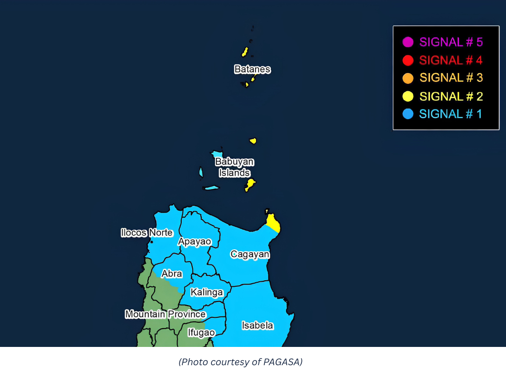
Strong winds will prevail in areas where signal no. 1 is hoisted: Batanes, Cagayan including Babuyan Islands, Isabela, Apayao, Abra, Kalinga, the eastern and central portions of Mountain Province (Paracelis, Natonin, Barlig, Sadanga, Bontoc, Besao, Sagada), the eastern and central portions of Ifugao (Mayoyao, Aguinaldo, Alfonso Lista, Banaue, Hingyon, Lagawe), Ilocos Norte, the northern portion of Ilocos Sur (Cabugao, Sinait, San Juan, Magsingal, Santo Domingo, Bantay, San Ildefonso, San Vicente), and the northern portion of Aurora (Dilasag, Casiguran)
PAGASA said the southwest monsoon or habagat and Kiyapo's periphery will also cause strong to gale-force gusts across Siquijor, Bohol, Southern Leyte, and most of Mindanao.
The eastern seaboard of Davao Oriental may experience rough seas.
Mariners of small seacraft, including all types of motorbancas, are advised not to venture to the sea.
Cagayan, Apayao, Batanes, Isabela, Kalinga, Abra, and Ilocos Norte will experience heavy rains due to Kiyapo.
The southwest monsoon will cause moderate to heavy rains across Negros Oriental, Zamboanga del Norte, Zamboanga Sibugay, Zamboanga del Sur, Lanao del Norte, Lanao del Sur, Maguindanao del Norte, Sultan Kudarat, and Sarangani.
Meanwhile, PAGASA said Kiyapo is forecast to intensify and possibly reach the tropical storm category by Friday.
The cyclone is expected to exit the Philippine Area of Responsibility by Saturday, PAGASA said. (PNA)
 Log in with Google